
Mapleton, ND – GIS Utility Mapping
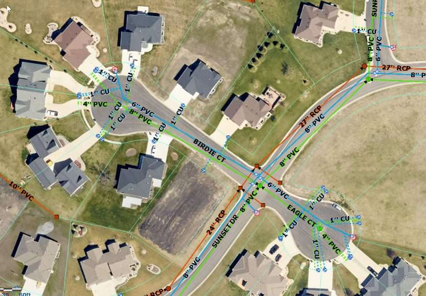
Challenge
Mapleton is a rapidly growing community. That’s a good thing. But city infrastructure needs to grow along with the population, and the city needed a way to better manage its utility systems. Paper maps would be out of date within months, and they were difficult to use when in the field trying to understand where infrastructure is located. Small towns also experience turn-over in staff, where information may be lost when the public works staff leaves.
Solution
Moore’s engineering and GIS staff created a comprehensive database of city utilities that can be easily accessed by all city staff on a web map. The utility database was created by converting the city’s existing paper maps/drawings, CAD record drawings and data files into electronic files that can be viewed in the web map.
Outcome
Mapleton is now able to quickly evaluate where utilities are located and the types of utilities they have. This helps with communication between city staff and also engineering. Many of the features in the map are survey grade accurate for location and elevation, and the city continues to improve the utility database. Better data that is readily available to all stakeholders leads to quicker and smarter decisions.