Grafton, ND – Flood Risk Reduction
CHALLENGE
The City of Grafton experiences widespread flooding from spring snow melt and summer rainfall events. The city lies along the Park River, just downstream of the confluence of the river’s three branches, with the McLeod Drain along Grafton’s southern edge. The flat topography of the Red River Valley results in not only riverine flooding but overland flooding several miles wide. Major floods of the 1950s resulted in the construction of several dams in the watershed upstream of Grafton. Although beneficial, the dams do not solve Grafton’s flooding problem on their own. A permanent flood control project was needed to relieve the risk of overtopped roads, damaged bridges and culverts, damage to structures, costly flood insurance, and economic losses to the business community.
SOLUTION
The complex floodplain required a highly technical analysis and design to determine a solution providing flood protection that could be accredited by FEMA without negatively impacting areas outside of the project. Moore Engineering’s team completed the following:
- Hydraulic modeling of existing floodplain and proposed project, including exterior impact and bridge scour analyses.
- Permitting with federal, state and local agencies
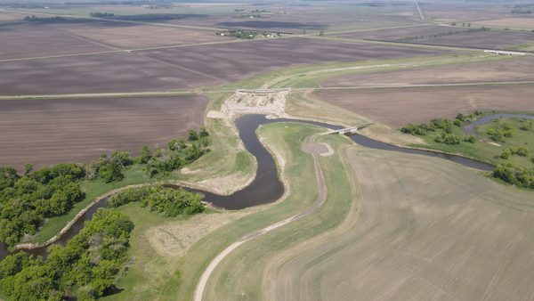
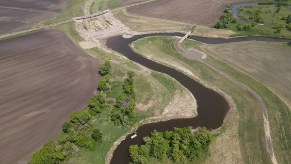
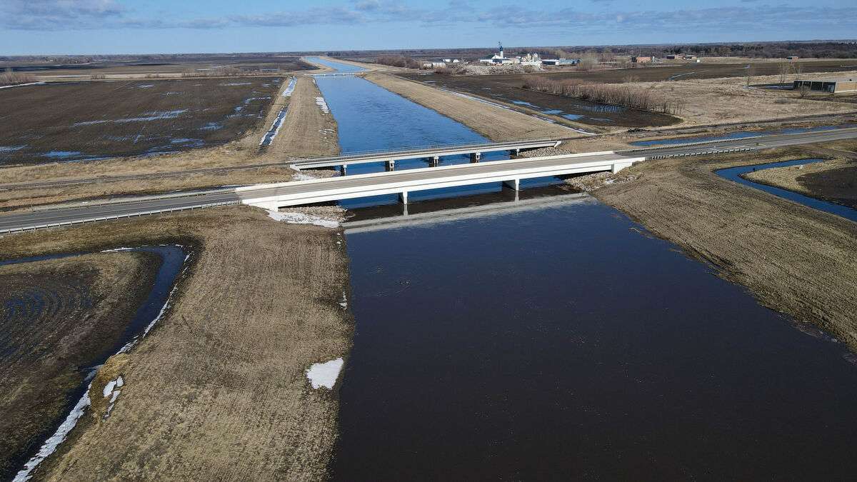
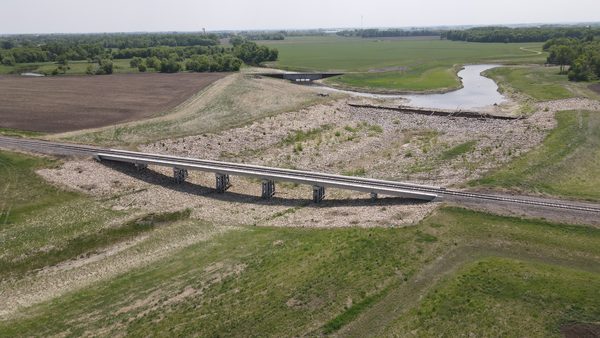
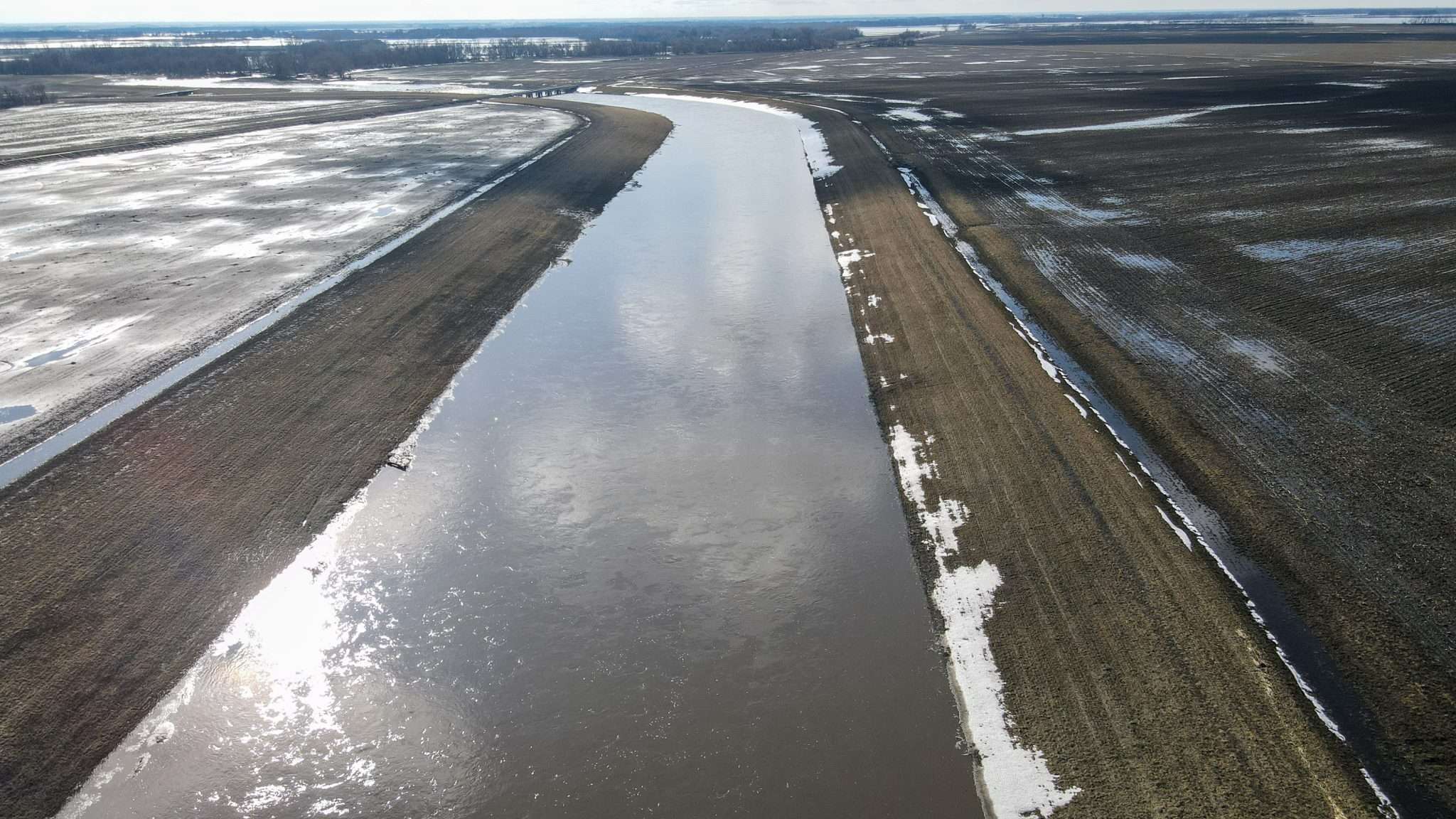
- Design of 12.2 miles of levees, a river closure structure, 2.9 miles of bypass channel, field access roads, crossings, and localized drainage improvements associated with the project.
- Pre-project Conditional Letter of Map Revision (CLOMR) submittal and post-project LOMR submittal to FEMA.
OUTCOME
After decades of planning and attempts to construct a project, the Grafton Flood Risk Reduction Project was successfully completed. Grafton and its residents can now rely on the project to protect them during floods, rather than having to shut down businesses and schools to sandbag. Annual flood insurance premiums have been reduced by roughly $500,000.