
GIS – Wastewater Collection & Treatment Improvements
CONTEXT & OBJECTIVE
GIS played a key role in Kindred’s new sanitary lagoon project from start to finish. During the study phase, it supported site selection through data collection and analysis. In design, GIS produced infrastructure maps, easement maps, and landowner exhibits. For construction, it enabled live data collection via interactive online maps. In closeout, GIS integrated record drawings into the city’s master geodatabase.
METHODOLOGY & TOOLS
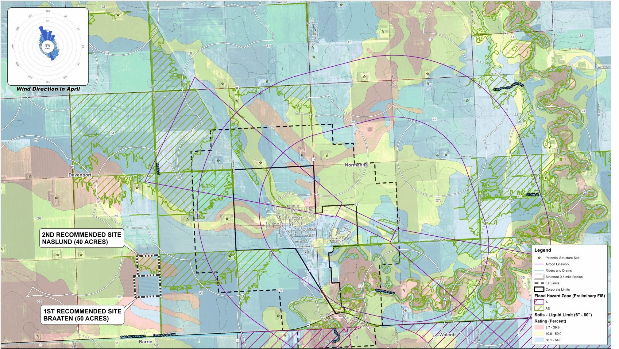
We began by gathering open-source datasets to assess lagoon site suitability—more complex than typical infrastructure projects due to strict sanitary lagoon regulations. Key datasets included soil types, airport proximity, wind direction, nearby structures, hydrology, and regulatory data. These were analyzed to identify viable locations.
To plan force main routes and easement corridors, we used parcel data, utility maps, and elevation models to develop conceptual alignments. Maps with aerial imagery and proposed easements helped landowners visualize project impacts during engagement.
During construction, ArcGIS Online and Field Maps enabled real-time field data collection, including georeferenced photos used in record drawings. Access to proposed layouts in the field was essential.
For record drawings, CAD data and field inputs were integrated into GIS, following a detailed QA/QC process. Attributes included pipe size, material, rim elevations, installation dates, and linked documents (e.g., specs, shop drawings). Final data was added to the city’s master GIS and published via web maps for future use in planning, locating, and maintenance.
OUTCOME
GIS added value throughout the project—streamlining site analysis, design, construction, and documentation. As a result, Kindred now has a modern, well-documented lagoon system to support long-term infrastructure needs.